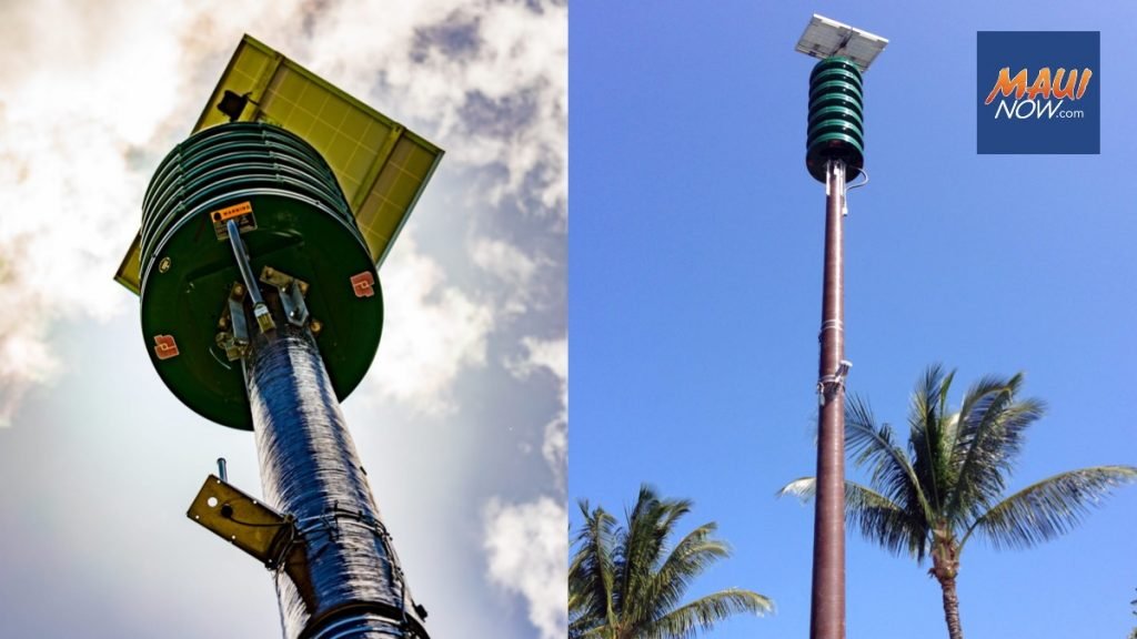
The Hawai‘i Emergency Management Agency has launched an interactive map that allows the public to easily locate and check the operational status of alert and warning sirens across the state. With 418 sirens currently in place, this map provides valuable information on sirens that are fully operational, require maintenance, or are beyond repair. By using different colors to signify the status of each siren, individuals can quickly assess the condition of sirens in their communities. This new tool aims to enhance transparency and improve the agency’s alert and warning systems, ensuring the safety and protection of residents in Hawai‘i.

This image is property of media.mauinow.com.
Hawai‘i Emergency Management Agency launches interactive map of statewide alert sirens
The Hawai‘i Emergency Management Agency (HEMA) has recently unveiled an interactive map that provides valuable information about the location and operational status of alert and warning sirens across the state. This new tool aims to enhance public awareness and preparedness in the event of an emergency.
Introduction
In an official announcement, HEMA introduced the launch of the interactive map, emphasizing its purpose of providing vital information about the statewide alert siren system. These sirens play a crucial role in alerting and warning the public during emergencies, making it essential for individuals to be aware of their significance and functionality.
Overview of the interactive map
The interactive map features a comprehensive overview of the alert and warning siren system in Hawai‘i. It provides detailed information about the total number of sirens across the state, their operational status, and the monthly testing of these sirens. The data displayed on the map reflects the results of the most recent monthly test conducted on October 2, 2023.
Results of the most recent monthly test
According to the data obtained from the most recent monthly test, there are a total of 418 alert and warning sirens in Hawai‘i. Out of these sirens, 326 (approximately 78%) are fully operational, while 29 sirens (around 6.9%) require immediate maintenance. Additionally, 37 sirens (approximately 8.9%) require maintenance that can be performed with contracting support, and 26 sirens (around 6.2%) are deemed beyond repair.

This image is property of media.mauinow.com.
Description of siren status
The interactive map utilizes different color codes to signify the operational status of the sirens. Fully operational sirens are displayed in green, while sirens requiring maintenance that can be performed by HEMA are shown in yellow. Sirens requiring maintenance with contracted assistance are marked in red, and sirens beyond repair are represented in black.
Significance of the interactive map
The interactive map holds significant importance as it allows the public to access and monitor the operational status of alert and warning sirens in their local communities. It promotes improved transparency of the siren network and assists individuals in staying informed and prepared during emergencies. The public’s awareness and understanding of the siren system are vital for their safety and well-being.
Reasons for inoperable sirens
There are various reasons why some sirens are rendered inoperable or beyond repair. Some sirens are close to 60 years old and need replacement, but due to development in the area, the original sites are no longer suitable. Additionally, sirens can be damaged by lightning, vandalism, or accidents, further impacting their functionality. It is important to address these challenges and ensure the reliability and effectiveness of the siren system.
Role of the All-Hazard Statewide Outdoor Warning Siren System
The All-Hazard Statewide Outdoor Warning Siren System serves as a critical tool for emergency alerts in Hawai‘i. It functions to alert the public in the event of any imminent hazard, signaling the need for individuals to seek additional information and take appropriate actions. The siren system is part of a larger network of alert systems that work together to ensure the public’s safety and awareness during emergencies.
Other tools for emergency alerts
In addition to the alert and warning siren system, Hawai‘i utilizes other tools for emergency alerts. The Wireless Emergency Alert system delivers alerts directly to mobile devices, ensuring immediate communication with the public. Furthermore, the Emergency Alert System broadcasts alerts via televisions and radios, providing another channel for delivering critical information. These additional tools, along with the siren system, contribute to a comprehensive and robust emergency alert system.
Accessing the map
The interactive map can be accessed on the HEMA website at ready.hawaii.gov by selecting the “Siren Status Map” option under the “Get Ready” tab. Alternatively, individuals can scan the provided QR code for quick access to the map. This user-friendly interface allows the public to easily view and understand the operational status of sirens in their respective communities.
Future enhancements to the map
HEMA has plans to continuously improve the interactive map by adding more information and enhancing its details and features over time. As technology and resources evolve, the map will become even more comprehensive and useful, further assisting the public in staying informed and prepared for emergencies.
In conclusion, the launch of the interactive map by HEMA is a significant step towards enhancing public awareness and preparedness in Hawai‘i. The map provides valuable information about the operational status of alert and warning sirens across the state, allowing individuals to stay informed and take appropriate actions during emergencies. With ongoing enhancements and improvements, the interactive map will continue to serve as a vital tool in safeguarding the people of Hawai‘i.
